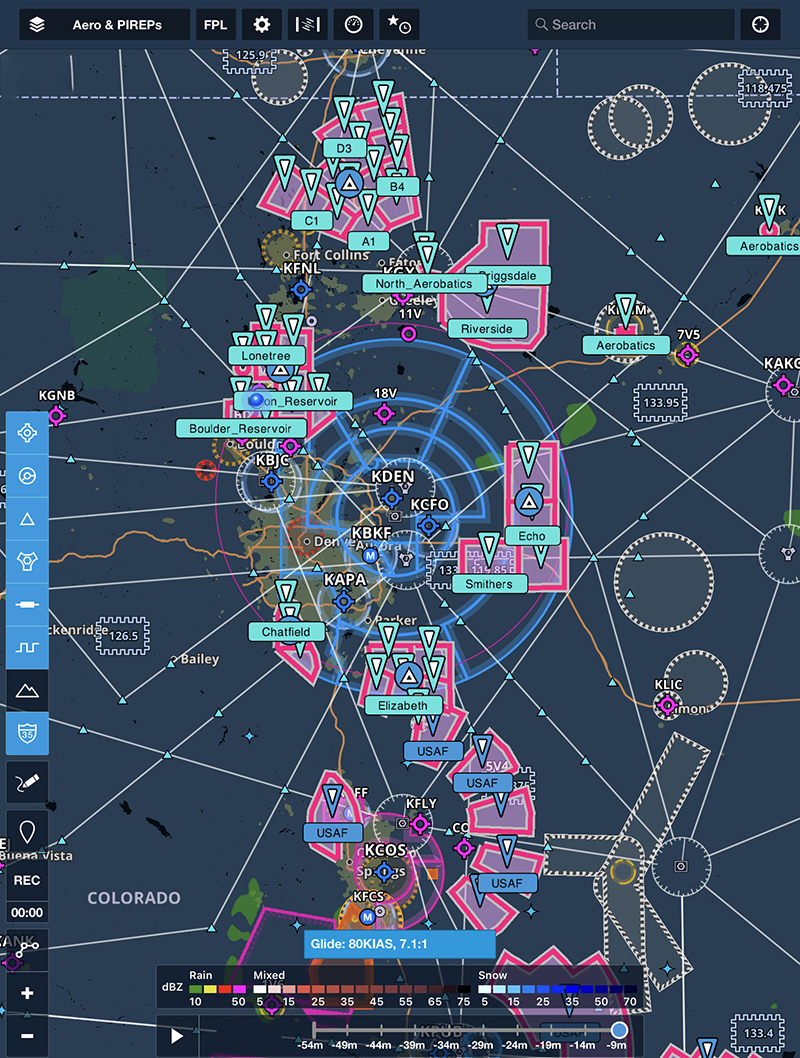
ForeFlight has created tremendous advances in situational awareness for pilots and the polygon feature certainly adds to the possibilities.
In 2017, ForeFlight introduced a feature that allows users to easily upload custom shapes onto ForeFlight maps. These custom shapes, or polygons, can be useful for many purposes but their ability to highlight important airspace is perhaps the most useful.
For quite some time, ForeFlight has allowed users to annotate and create custom markings on instrument charts and airport diagrams. However, when it came to marking airspace on a sectional or enroute chart, a paper chart and a highlighter were your best bet. But now, users can create custom shapes using files created in Google Earth and saved using the common .KML file format.
Here’s just one example of how these polygon layers can be useful: Flight training practice areas along the front range can see a large volume of traffic on any given day. Seldom depicted on charts, these practice areas are more commonly identified by geographic features such as roads, tree lines, and rivers. However, unless you’re familiar with a flight school’s operations, it might be possible to pass through one of these high training volume areas without any awareness of the potential hazard that exists.
To add to awareness, we’ve created a KML file that contains the practice areas commonly used by flight schools in the Denver area. Below, you can see the southwest and southeast practice areas used by flight schools based at Centennial as well as the aerobatic practice “box” north of Longmont. Users can then easily add their own shapes and lines using free programs such as Google Earth.
To download the .ZIP file containing the KML, click here.
Keep in mind that these areas should be used for airspace awareness only, not as a hard-and-fast guide — All pilots know the importance of a good traffic scan whether inside or outside of one of these areas.
For instructions on how to load the file on your iPad, visit ForeFlight’s help section, here.
Creating your own file is easy and can be done using tools available for free (the aforementioned Google Earth and iTunes, for example). ForeFlight has detailed instructions on the process as well as samples that show all options that exist for custom polygons. You can find out more information on their support website.


